Radstationen

Hauptseite > Öffentlicher Verkehr > Fahrrad
Quellen:
https://radland.at/service-stationen/
openstreetmap.org
maps.google.com
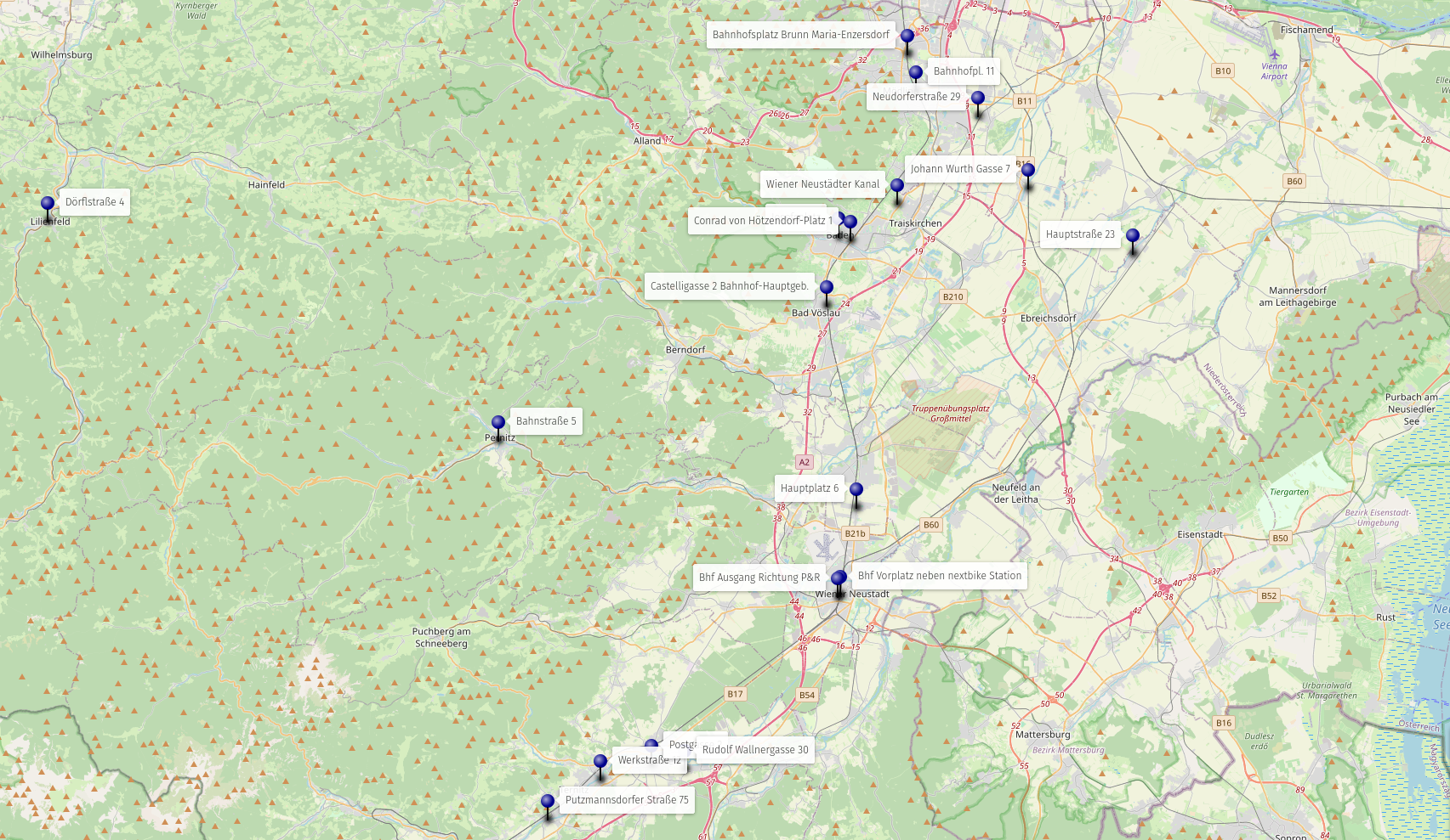
Bad Vöslau
Castelligasse 2 Bahnhof-Hauptgeb.
![]() https://www.openstreetmap.org/node/11623672106
https://www.openstreetmap.org/node/11623672106
🧭 47.9691416,16.2233296
![]() https://maps.app.goo.gl/ME7GUFtLzMQDWThv6
https://maps.app.goo.gl/ME7GUFtLzMQDWThv6
Baden
Josefsplatz
![]() https://www.openstreetmap.org/node/9368223336
https://www.openstreetmap.org/node/9368223336
🧭 48.00650151915868, 16.232788266729674
![]() https://maps.app.goo.gl/qBKNVoRn2xz8fx1A9
https://maps.app.goo.gl/qBKNVoRn2xz8fx1A9
Conrad von Hötzendorf-Platz 1
![]() https://www.openstreetmap.org/node/1982602553
https://www.openstreetmap.org/node/1982602553
🧭 48.004572725330355, 16.242926096831244
![]() https://maps.app.goo.gl/VTBg8ybvS5xQm6aQ6
https://maps.app.goo.gl/VTBg8ybvS5xQm6aQ6
Brunn am Gebirge
Bahnhofsplatz Brunn Maria-Enzersdorf
![]() https://www.openstreetmap.org/node/7017826840
https://www.openstreetmap.org/node/7017826840
🧭 48.104858741335704, 16.288419443989845
![]() https://maps.app.goo.gl/p7yf4fQJmf7o2roy6
https://maps.app.goo.gl/p7yf4fQJmf7o2roy6
Laxenburg
Neudorferstraße 29
![]() https://www.openstreetmap.org/node/8457544338
https://www.openstreetmap.org/node/8457544338
🧭 48.071791384840544, 16.34548979558414
![]() https://maps.app.goo.gl/cvygSKbpZuVy3vic8
https://maps.app.goo.gl/cvygSKbpZuVy3vic8
Lilienfeld
Dörflstraße 4
![]() https://www.openstreetmap.org/node/9592455874
https://www.openstreetmap.org/node/9592455874
🧭 48.014906747965505, 15.594291586415626
![]() https://maps.app.goo.gl/N51xcU6iQaD1ajrz5
https://maps.app.goo.gl/N51xcU6iQaD1ajrz5
Mitterndorf an der Fischa
Hauptstraße 23
![]() https://www.openstreetmap.org/node/9900554681
https://www.openstreetmap.org/node/9900554681
🧭 47.997313364229946, 16.470573442185373
![]() https://maps.app.goo.gl/DyYj6KejFQ7sLfbJA
https://maps.app.goo.gl/DyYj6KejFQ7sLfbJA
Mödling
Bahnhofpl. 11
![]() https://www.openstreetmap.org/node/3710225296
https://www.openstreetmap.org/node/3710225296
🧭 48.08532287419636, 16.29545319013206
![]() https://maps.app.goo.gl/gCww3Cs8dfKQwPcB8
https://maps.app.goo.gl/gCww3Cs8dfKQwPcB8
Münchendorf
Johann Wurth Gasse 7
![]() https://www.openstreetmap.org/node/6388598846
https://www.openstreetmap.org/node/6388598846
🧭 48.0325459057901, 16.38572700223887
![]() https://maps.app.goo.gl/fdviLFx6ryP4ZDBU7
https://maps.app.goo.gl/fdviLFx6ryP4ZDBU7
Natschbach-Loipersbach
Rudolf Wallnergasse 30
![]() https://www.openstreetmap.org/node/7366673616
https://www.openstreetmap.org/node/7366673616
🧭 47.71783443988949, 16.108943690654026
![]() https://maps.app.goo.gl/nNNDx1vUi2DWyR1N7
https://maps.app.goo.gl/nNNDx1vUi2DWyR1N7
Neunkirchen
Postgasse 2
![]() https://www.openstreetmap.org/node/7846451412
https://www.openstreetmap.org/node/7846451412
🧭 47.720633026952314, 16.082242862328773
![]() https://maps.app.goo.gl/KbeQw6CkX8fbPDXZA
https://maps.app.goo.gl/KbeQw6CkX8fbPDXZA
Pernitz
Bahnstraße 5
![]() https://www.openstreetmap.org/node/4614969772
https://www.openstreetmap.org/node/4614969772
🧭 47.89610962468225, 15.958278038692027
![]() https://maps.app.goo.gl/Y55F6UxJJUidvmbQ9
https://maps.app.goo.gl/Y55F6UxJJUidvmbQ9
Pressbaum
Hauptstraße 89
?
360°-Fotos: [ google.com]
![]()
🧭
![]()
Putzmannsdorf
Putzmannsdorfer Straße 75
![]() https://www.openstreetmap.org/node/7729021842
https://www.openstreetmap.org/node/7729021842
🧭 47.69055729656957, 15.99817457745267
![]() https://maps.app.goo.gl/UEjMjvgX8yQTxBvW8
https://maps.app.goo.gl/UEjMjvgX8yQTxBvW8
Schwechat
Bhf Vorplatz neben nextbike Station
![]() https://www.openstreetmap.org/node/4254886318
https://www.openstreetmap.org/node/4254886318
🧭 48.14296589553021, 16.482168010622637
![]() https://maps.app.goo.gl/qL3FvFBTx7Cxm7eAA
https://maps.app.goo.gl/qL3FvFBTx7Cxm7eAA
Ternitz
Werkstraße 12
![]() https://www.openstreetmap.orgnode/9827809738
https://www.openstreetmap.orgnode/9827809738
🧭 47.712292848895174, 16.04092281226928
![]() https://maps.app.goo.gl/TxRsQCCzSiw5TotX9
https://maps.app.goo.gl/TxRsQCCzSiw5TotX9
Theresienfeld
Hauptplatz 6
![]() https://www.openstreetmap.org/node/1794420644
https://www.openstreetmap.org/node/1794420644
🧭 47.859725947718104, 16.24762137839611
![]() https://maps.app.goo.gl/KUeGxh3awWfhP1X78
https://maps.app.goo.gl/KUeGxh3awWfhP1X78
Traiskirchen
Wiener Neustädter Kanal
![]() https://www.openstreetmap.org/node/9971573061
https://www.openstreetmap.org/node/9971573061
🧭 48.02425454194671, 16.280449314742974
![]() https://maps.app.goo.gl/PoeaD7HUM1DthUuu8
https://maps.app.goo.gl/PoeaD7HUM1DthUuu8
Wr. Neustadt
Bhf Ausgang Richtung P&R
![]() https://www.openstreetmap.org/way/125205975#map=19/47.81141/16.23248
https://www.openstreetmap.org/way/125205975#map=19/47.81141/16.23248
🧭 47.8116964026558, 16.2326090032824371
![]() https://maps.app.goo.gl/czpZu4xUJ2CW1Gme72
https://maps.app.goo.gl/czpZu4xUJ2CW1Gme72
Bhf Vorplatz neben nextbike Station
![]() https://www.openstreetmap.org/node/1552554379
https://www.openstreetmap.org/node/1552554379
🧭 47.81210189866528, 16.234490149591778